Boca Raton Drawbridge Commute Guide for East Boca Renters
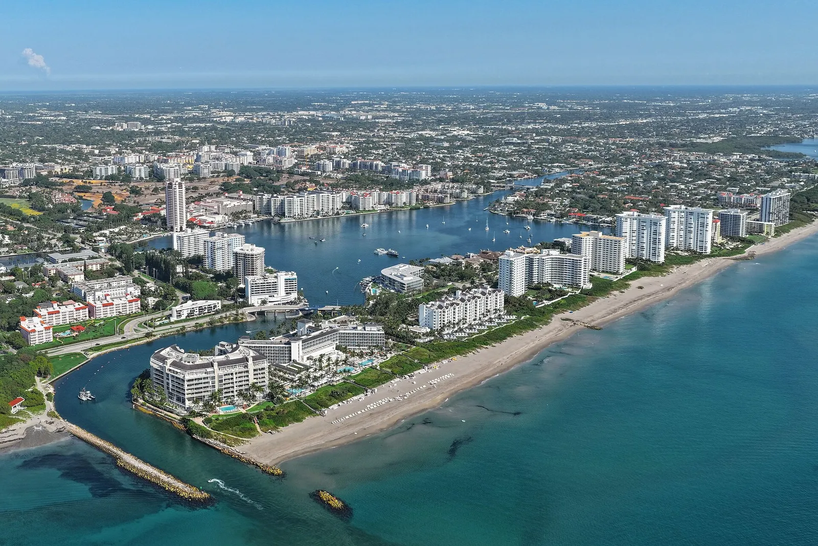
Before signing a lease, East Boca renters should look at bridge dependence along with mileage. A barrier-island home may seem close to downtown, work, or the train station, yet a bridge opening or malfunction can turn a short trip into a long detour. Drive the route during your usual travel hours, identify at least one usable alternate crossing, and consider how much schedule uncertainty your household can handle.
Beachside living comes with a practical consideration: the Intracoastal Waterway works like a moving intersection, with road traffic sometimes waiting while boats pass.
What the Camino Real malfunction showed renters
On October 27, 2026, Boca Raton police reported that the Camino Real Bridge was closed because of a malfunction. The first advisory told drivers to find another route and gave no estimated reopening time. A later update said the bridge had reopened that afternoon, according to Boca Post’s report and update.
The closure was temporary, but it raised an everyday housing question. If your rental is east of the Intracoastal while your job, school, doctor, or train is on the mainland, how much of your routine depends on one movable bridge?
A short closure affects more than one road
When Camino Real is unavailable, many drivers redirect toward Palmetto Park Road, adding vehicles to the closest practical alternative. Depending on their starting point and destination, others may head north toward Spanish River Boulevard.
Delays are rarely limited to the bridge. They can spread to A1A, Federal Highway, nearby approaches, and the intersections where drivers join the detour. As queues develop, a navigation app may change its recommendation several times.
The useful renter takeaway
A quiet midday showing does not tell you enough about an East Boca commute. Consider what happens when your preferred crossing is raised, blocked, or backed up. The better fit is a rental with an alternate route that still works for appointments you cannot miss.
Know Boca Raton’s three Intracoastal crossings
The City of Boca Raton identifies four drawbridges: Camino Real, Palmetto Park Road, and Spanish River Boulevard cross the Intracoastal, while the A1A bridge crosses the Boca Raton Inlet. For most commutes between the barrier island and mainland, the first three are the useful choices.
| Crossing | Normal opening pattern | Best practical role for renters |
|---|---|---|
| Camino Real | On the hour and at 20 and 40 minutes past the hour | Southern East Boca trips, including routes from the Royal Palm Yacht & Country Club and Boca Raton Resort area |
| Palmetto Park Road | On the hour and half-hour | Direct access toward downtown, Federal Highway, and central Boca Raton |
| Spanish River Boulevard | On the hour and half-hour | Northern barrier-island trips and access toward Federal Highway, FAU, and the I-95 corridor |
These opening patterns come from the city’s marine information page and the Palm Beach County drawbridge schedule. Use them as planning anchors rather than guarantees that your car will cross at a precise minute. Boats, emergency operations, maintenance, traffic signals, and the time required to lower the span can all affect the road queue.
Camino Real: convenient with frequent interruptions
Camino Real has the most frequent scheduled openings of the three Intracoastal crossings. That can make a difference when it is the only natural route from your home. Arriving shortly before an opening may leave you waiting through the lift and the line of vehicles ahead.
Its southern location is useful for homes near South Inlet Park, Lake Boca, and the southern portion of A1A. When Camino is closed, Palmetto Park Road is usually the first alternate to assess, though the detour can become congested.
Palmetto Park Road: the central downtown crossing
Palmetto Park Road is the most direct central crossing for many downtown destinations. West of the bridge, it continues through the Federal Highway and Mizner Boulevard area before reaching the broader mainland street network.
Its convenience also concentrates traffic. Renters headed to downtown Boca, the Brightline station, or I-95 should test Palmetto and an alternate route instead of assuming the central crossing will always be fastest.
Spanish River Boulevard: the northern alternative
Spanish River Boulevard is useful for residents near Spanish River Park and the north end of Boca’s barrier island. It can serve as a backup when the central crossings have problems, although the drive north may cancel that advantage for someone starting near Camino Real.
Use the official Boca Raton city map to trace the connections among Spanish River Boulevard, Federal Highway, Glades Road, FAU Boulevard, and I-95. The map shows the geographic tradeoff more clearly than a listing’s mileage estimate.
Match the bridge to your real destination
A crossing that suits one commuter may be a poor choice for another. Begin with the destination you visit most often, then work backward to the barrier-island neighborhood you are considering.
Downtown Boca Raton and Brightline
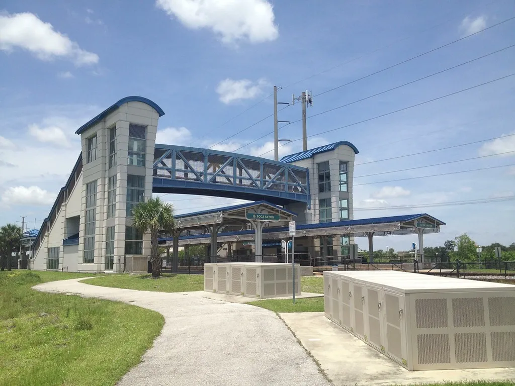
Palmetto Park Road is generally the most direct crossing for downtown. The Brightline Boca Raton station is at 101 NW Fourth Street, on the mainland side near the Downtown Library.
A train departure leaves less room for delay than an ordinary office arrival. Missing it can disrupt the rest of your trip, so include a bridge contingency in your station plan. During a lease tour, drive from the property to the station, find the garage entrance, and note which crossing your navigation app chooses when Palmetto is delayed.
I-95 and Florida Atlantic University
Drivers going to I-95 must travel west from A1A, cross the Intracoastal, and continue through Boca’s mainland grid. Spanish River Boulevard may suit the north end of the island, while Palmetto Park Road or Camino Real may work better from a more southerly address.
For FAU, compare Spanish River Boulevard with a Palmetto-to-mainland route during more than one test drive. The official FAU Boca Raton campus map shows the internal campus roads, which add another part to the trip after you leave the bridge corridor.
Boca Raton Regional Hospital
Hospital trips call for a stricter standard than casual errands. Staff members should test the route near their actual shift change. Patients should leave a separate buffer for parking and check-in.
When an on-time arrival is essential, find out whether the rental gives you practical access to more than one Intracoastal crossing. A household with frequent medical appointments may place more value on mainland East Boca than an address east of the water, even if the island home looks close on a map.
Why the same commute changes from day to day
Scheduled openings and marine traffic
The posted schedule tells you when a bridge may open. It cannot tell you how long the vehicle queue will be. A larger vessel movement, several boats arriving together, or heavy traffic on the approaches may extend the interruption.
Watch the clock during a tour. If you reach Camino Real near the hour or one of its other scheduled opening times, observe the full cycle until traffic returns to normal. Repeat the exercise at Palmetto or Spanish River near an hour or half-hour opening.
Crashes, maintenance, and electrical problems
A drawbridge is a roadway and a mechanical system. Its gate arms, signals, electrical controls, and movable spans must all work correctly. The October malfunction is one example. An ordinary crash or lane closure near an approach can cause a similar commuting delay.
Before leaving, check FL511, Florida’s official real-time traffic service. Its service description says it reports congestion, construction, lane closures, severe weather, travel times, and alternative routes on covered roads.
Rain, high water, and storms
Heavy rain reduces visibility and can slow A1A and the bridge approaches while the span is operating normally. Water collecting on a low road or an incident elsewhere may also push more traffic onto your preferred route.
During hurricane season, follow official evacuation and emergency instructions instead of relying on a familiar commute. When weighing a rental, consider daily bridge dependence along with the property’s broader storm and flood exposure.
A four-part commute test before signing
A useful test drive should follow your schedule rather than the leasing agent’s. Save each result in your phone and record the cause of any delay, such as a bridge opening, school traffic, rain, or a difficult garage exit.
- Weekday departure: Leave the property when you would normally travel to work, FAU, the hospital, or the station. Take the bridge your navigation app recommends.
- Weekday return: Repeat the trip in the opposite direction. A route that feels easy in the morning may queue differently in the afternoon.
- Weekend beach traffic: Test the A1A and Palmetto Park Road area when residents and visitors are going to the beach, parks, restaurants, or downtown.
- Rainy-condition check: If possible, return during ordinary rain. Look at drainage, visibility, pedestrian activity, and how quickly traffic backs up near the approaches.
Use a simple decision rule
For each rental, write down the primary bridge, a backup bridge, and the consequence of being late. If the backup takes you far in the wrong direction or feeds into the same bottleneck, the home is more bridge-dependent than it first seemed.
Decide how much extra time you can accept. A remote worker with flexible hours may be comfortable with more uncertainty than a nurse, teacher, parent handling a fixed pickup, or rail commuter with a booked departure.
Test the last block, too
Commute trouble can hide at the property entrance. Check whether you can turn in both directions, whether resident or guest gates create queues, and whether parked cars restrict visibility. At the mainland end, test the actual office, campus, hospital, or station entrance instead of stopping the timer at the neighborhood boundary.
Questions to ask during a lease tour
- Which bridge do current residents normally use, and what is their backup?
- Can the property be reached from both directions on A1A, or does a median or gate limit access?
- Where do residents park during high water, maintenance, or a storm warning?
- How do emergency vehicles and essential vendors enter when the nearest bridge is unavailable?
- Are deliveries left at the unit, a lobby, a gatehouse, or another collection point?
- Does the association restrict commercial vehicles, overnight guests, or backup parking?
- Is the internet connection sufficient for a remote-work day when a road delay makes the office impractical?
- Who sends building or community alerts about access problems?
Separate location value from commute value
A beachside address may provide walks along the ocean and quick access to parks. Those benefits do not guarantee a dependable mainland commute. Compare the address with rentals west of the Intracoastal that offer convenient downtown access without a movable crossing.
Browse the broader Boca Raton renter guides and the current rental property list to compare locations. A mainland home such as the Helsinki Circle Lakeview Home, used only as a geographic comparison and not a statement of current availability, shows how far west some Boca options are from the drawbridge network.
Build a practical bridge-delay backup plan
For fixed-time commuters
Before move-in, save the address of your destination and both viable crossings. Check traffic before getting into the car, especially when the trip involves a train, medical shift, school bell, or scheduled appointment.
Keep the destination’s phone number handy. If a malfunction closes the road without an estimated reopening time, notify the appropriate person early and reroute instead of waiting beside the bridge for an uncertain repair.
For remote and hybrid workers
A bridge delay may make a planned office day impractical, so confirm that the home can support a backup workday. Test cellular reception inside the unit, ask which internet provider serves it, and find out whether the individual unit or building association controls the power or internet equipment.
Keep essential files available through your employer’s approved system and bring work equipment home before severe weather. This plan is for continuity when it is safe to remain home. Follow official instructions if you are told to evacuate.
For households sharing one vehicle
A bridge delay is harder to manage when one driver handles several pickups. Plot the entire chain, including home, work, school, appointments, and the return trip across the Intracoastal.
If one closure would make that chain impossible, discuss car-pool contacts, authorized school pickup alternatives, a mainland meeting point, or occasional rideshare costs before signing. This planning exercise may tell you more about the rental’s fit than another walk through the kitchen.
Choose the home that fits your tolerance for uncertainty
East Boca can suit renters who value the beach and a coastal routine. The tradeoff is that a short mainland trip may depend on movable infrastructure, so its reliability can matter more than the mileage in a listing.
For help comparing Boca Raton rentals by bridge dependence, work location, and realistic alternate routes, contact Oasis Rentals at (561) 299-0336 or info@oasis-rentals.com. Bring your usual destination and departure time so the discussion can focus on the way you travel.
Sources
- Boca Post: Camino Bridge closed after malfunction
- City of Boca Raton: Marine Information and drawbridges
- Palm Beach County: Drawbridge Opening Schedule
- City of Boca Raton: Official city map
- Brightline: Boca Raton station information
- Florida Atlantic University: Boca Raton campus map
- Florida 511: Real-time traffic information
- Florida 511: Service FAQ
FAQ
Which Boca Raton bridge opens most frequently?
Under the published schedule, Camino Real opens on the hour and at 20 and 40 minutes past the hour. Palmetto Park Road and Spanish River Boulevard open on the hour and half-hour.
What is the best alternate when Camino Real Bridge is closed?
Palmetto Park Road is usually the closest practical alternate. Spanish River Boulevard may work better for northern destinations. Check real-time traffic because rerouted vehicles can quickly congest the nearest crossing.
Which bridge is best for the Boca Raton Brightline station?
Palmetto Park Road is generally the most direct central crossing from the barrier island to downtown. Test a backup route and allow additional time for a booked train departure.
How should FAU commuters evaluate an East Boca rental?
Test Spanish River Boulevard and a route using Palmetto Park Road during the hours you attend class or work. Continue each test to the actual campus entrance and parking area.
Where can renters check Boca Raton traffic before leaving?
Use FL511 for information about congestion, construction, closures, weather, and alternate routes on covered roads. Local police and city alerts may have further details about a specific bridge malfunction.
Should a drawbridge stop me from renting on the barrier island?
Not necessarily. Drawbridge access should factor into the decision if you have fixed shifts, school pickups, medical appointments, or frequent train trips. Identify a workable alternate route and test both crossings before signing.
Photo credits: Quintin Soloviev / CC BY 4.0; Phillip Pessar / BY 2.0